Map
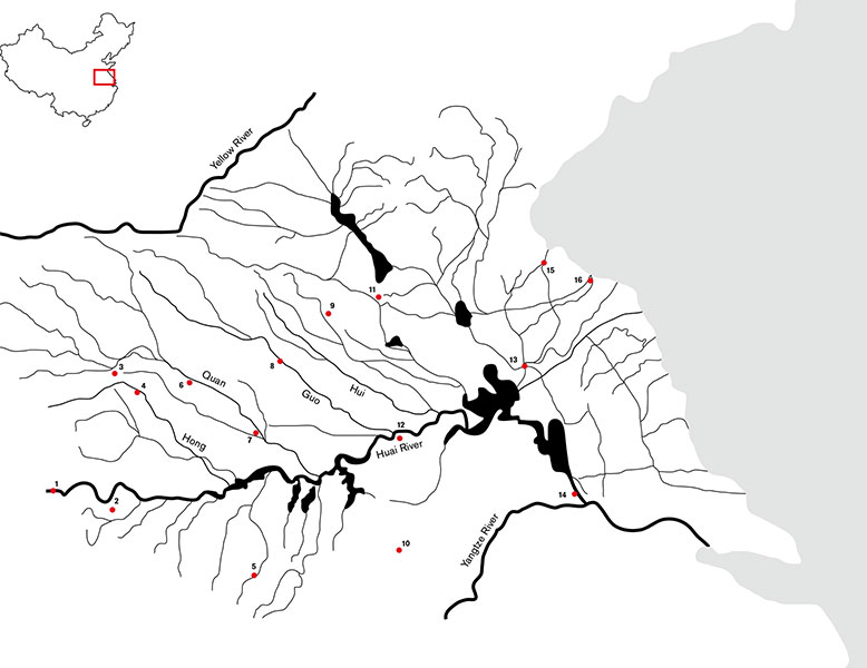
The Huai River drainage basin is a complex water system. It consists not only of the Huai River itself but of many tributaries both large and small, of canals, lakes, ponds, and natural and artificial reservoirs. In order to get a solid understanding of the river, one must travel in a nonlinear fashion, taking detours along the way. While the places I visited are not located on a linear route, the images in this book are arranged so that by flipping from one page to the other, the reader is virtually traveling from west to east, from the river's source to the river's mouth.
1) Tongbai Mountains, Source, Henan Province
2) Xinyang, Henan Province
3) Luohe, Henan Province
4) Xiangcheng, Henan Province
5) Jinzhai, Anhui Province
6) Jieshou, Anhui Province
7) Fuyang, Anhui Province
8) Guoyang, Anhui Province
9) Suzhou, Anhui Province
10) Hefei, Anhui Province
11) Xuzhou, Jiangsu Province
12) Bengbu, Anhui Province
13) Huai'an, Jiangsu Province
14) Yangzhou, Jiangsu Province (Yangtze River confluence)
15) Lianyungang, Jiangsu Province
16) Yellow Sea, Jiangsu Province (estuary)